The Planetary Problem-Solving Machine: How AI for Good Is Building a Better World
Quick Summary (TL;DR)
• The Data Divide is Real: Many communities are invisible on commercial maps, hindering access to basic services and disaster relief. This disparity in data access exacerbates social inequalities.
• Data is Being Democratized: A surge in satellites, drones, and crowdsourcing platforms like OpenStreetMap is empowering communities to map their own worlds, creating tools for advocacy and survival.
• The Ultimate Trio: Combining open data, advanced AI models, and scalable cloud infrastructure creates a "planetary problem-solving machine" capable of tackling humanity's biggest challenges, from climate change to healthcare.
—
In January 2007, a story of loss highlighted a critical gap in our technological capabilities. Dr. Werner Vogels, Amazon's CTO, recounts the disappearance of his friend and mentor, Jim Gray, at sea. Despite deploying every available resource, including government satellites, he was never found. Vogels wonders if today's AI for good would have changed the outcome. It’s a sobering thought that underscores a massive shift: we can now do things that were science fiction just over a decade ago.
But this power isn't distributed equally. For every meticulously mapped shopping district in a major city, there are entire communities that exist as blank spots on our digital maps. This isn't just a cartographical oversight; it's a humanitarian crisis in the making. This article explores the concept of the "data divide," how new technology is empowering us to close it, and how the principles of using AI for good can be applied by everyone, from non-profits to forward-thinking eCommerce brands, to make the invisible, visible.
What is the 'Data Divide'?
The "data divide" is the stark disparity in data access that mirrors and worsens existing social inequalities. As Vogels points out, most maps are created for commercial purposes, not humanitarian needs. We map what's profitable. The result? Communities like Makoko in Lagos, Nigeria—home to over 300,000 people on stilt houses—appear as a blank blue spot on Google Maps. They are effectively invisible.
This invisibility means no access to basic services, no efficient emergency response, and no seat at the table when infrastructure decisions are made. When the 2010 Haiti earthquake struck, international rescue teams arrived in a city that was, for all practical purposes, unmapped. They had GPS coordinates but no way to distinguish a major road from a dead-end alley. This is the data divide in action, and its consequences can be fatal.
Why Closing the Data Divide Matters
Bridging this gap isn't just about creating better maps; it's about building a more equitable and resilient world. The applications are transformative, touching everything from disaster relief to public health and environmental protection.
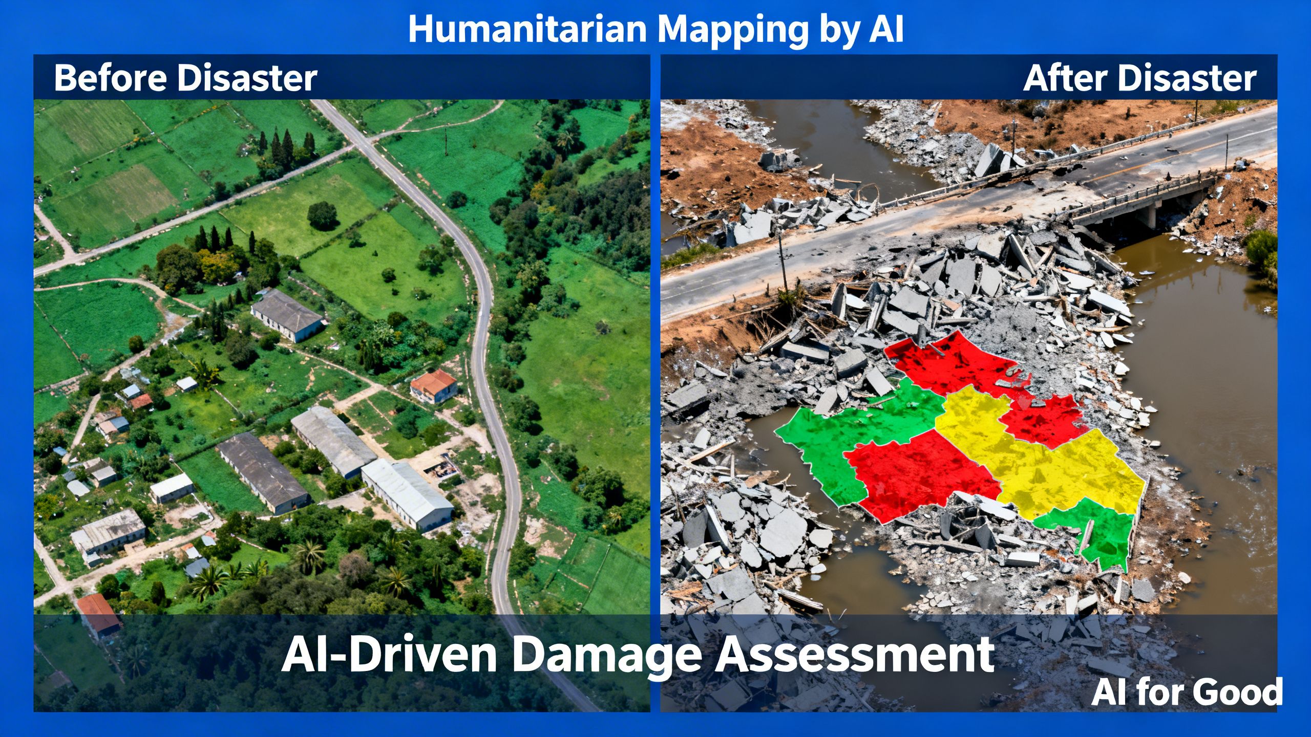
Revolutionizing Disaster Response: From Chaos to Coordinated Action
When disaster strikes, information is the most valuable currency. In the immediate aftermath of the Haiti earthquake, the official maps were useless. But within 48 hours, something incredible happened. Roughly 600 members of the OpenStreetMap community, working remotely, created the first reliable crisis map of Port-au-Prince.
This crowdsourced map became the default navigation tool for every major responding organization, from the UN to the US Marine Corps. It proves that when data is open, collective action can achieve what centralized authorities cannot.
This wasn't a one-off event. The Humanitarian OpenStreetMap Team (HOT) now specializes in this kind of rapid-response mapping, demonstrating a powerful model for future crisis management.
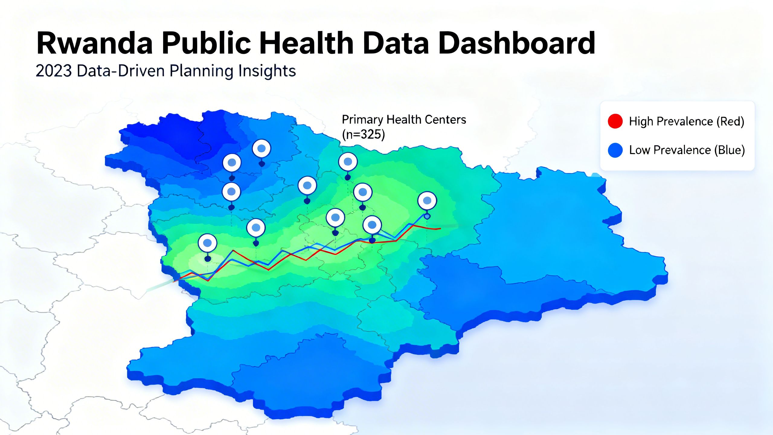
Transforming Public Health: Data-Driven Healthcare Delivery
In Rwanda, the Health Intelligence Center is using geospatial data to fundamentally change how healthcare is delivered. By combining real-time data on healthcare utilization with maps, they calculated the maximum walking distance for pregnant women to reach a health center. This isn't an academic exercise—this data directly informs where new facilities are built, optimizing resource allocation and saving lives.
This is a prime example of using data to answer critical questions and drive real-world decisions. It moves public health from a reactive model to a proactive, predictive one, ensuring care is accessible to those who need it most.
The Toolkit for Change: A Guide to Democratizing Earth Data
So, how do we move from identifying the problem to actively solving it? The good news is that the tools for data collection and analysis are more accessible than ever. Here’s a breakdown of the modern toolkit for humanitarian mapping.
Step 1: Leverage Crowdsourced and Collaborative Mapping
The success of OpenStreetMap in Haiti wasn't an anomaly; it was the blueprint. Platforms like OSM, HOT, and Missing Maps allow anyone, anywhere, to contribute to mapping the world's most vulnerable places. This democratizes the process, taking power from purely commercial interests and placing it in the hands of a global community.
Key Tip: For organizations, this means you don't have to build from scratch. You can contribute to and leverage these open platforms. For individuals, it means you can help map a village from your laptop.
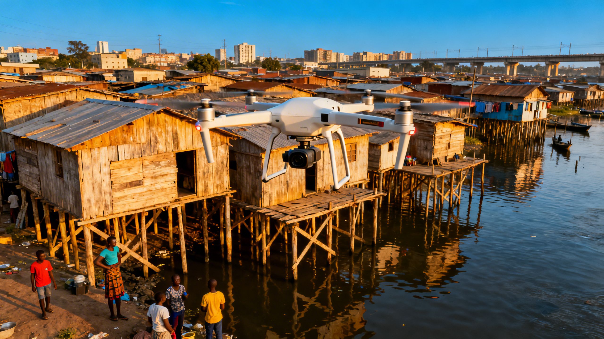
Step 2: Deploy Drones and IoT for Granular, Real-Time Insights
Satellites are powerful, but they can be expensive and don't always provide the necessary detail. Drones have emerged as a game-changing complement. In the Mapping Makoko project, local residents were trained to pilot drones and map their own community. This didn't just create a map; it created a tool for political advocacy.
Similarly, the Internet of Things (IoT) provides another layer of real-time data. Environmental sensors tracking air quality, water levels, or seismic activity can feed directly into mapping systems, creating a dynamic, living picture of a community's environment.
Key Tip: The Ocean Cleanup project uses AI-powered cameras on bridges to identify plastic types in real-time, showing how combining IoT with AI can lead to highly effective, targeted interventions.
Step 3: Utilize Open Data and Scalable Cloud Infrastructure
The sheer volume of geospatial data—hundreds of petabytes—is staggering. Storing and processing it requires robust infrastructure. Cloud platforms like Amazon S3 make this possible at scale. Programs like the AWS Open Data Sponsorship Program go a step further by covering the storage and transfer costs for high-value public datasets, removing a major barrier to entry for non-profits and researchers.
Key Tip: The goal is to create a flywheel effect. Open data attracts more analysis, which generates more insights, which in turn encourages more data to be opened. It's a virtuous cycle powered by the cloud.
AI for Good: Real-World Impact in Action
These tools and principles are already being used to achieve incredible things. The examples are not just theoretical; they are happening right now and changing lives.
Specific Practice: Mapping the Unmapped in Makoko
The Makoko project is a powerful case study. By training residents to use drones, the initiative did more than just fill a blank spot on a map. It empowered the community with undeniable proof of their existence, giving them a powerful tool to negotiate with the government for basic services and resist eviction. It's a perfect illustration of how democratized data collection becomes a tool for justice.
Specific Practice: Cleaning Our Oceans with AI
The Ocean Cleanup project is a masterclass in data-driven environmentalism. Their goal to remove 90% of ocean plastic by 2040 is audacious, but their method is surgical. They use drones, AI analysis of river flows, and even GPS-tagged dummy plastics to predict where plastic waste will accumulate. This allows them to position their cleanup systems for maximum impact, turning a seemingly impossible problem into a solvable logistical challenge.
Why This Matters for Your Business (Even in eCommerce)
At first glance, humanitarian mapping and selling products online might seem worlds apart. But the underlying principles are universal. The core idea is about using data to make the invisible visible and turn complex information into actionable insights. This is where the worlds of social good and smart business converge.
Whether you're tracking plastic in a river or analyzing your Amazon sales data, the goal is the same: find the patterns, understand the system, and make better decisions. Modern eCommerce is an incredibly complex ecosystem of supply chains, customer behavior, and advertising algorithms. Thriving requires moving beyond simple dashboards and gut feelings.
This is where a platform like TrackIQ becomes essential. Just as humanitarian AI sifts through petabytes of geospatial data, TrackIQ acts as your company's dedicated data analyst. It uses agentic AI to monitor your sales, inventory, and advertising data 24/7, surfacing insights you didn't even know to look for.
Instead of drowning in spreadsheets, you can simply ask questions in plain English, like "Why did my sales for ASIN X drop last week?" and get immediate, data-backed answers. It’s about turning the chaos of your business data into a clear, competitive advantage.
Common Pitfalls in Data-for-Good Projects
Embarking on a data-driven journey, whether for social good or for profit, comes with its own set of challenges. Avoiding these common mistakes is crucial for success.
The Mistake: Ignoring the Commercial Bias in Data
A critical error is to blindly trust existing data without questioning its origin. As Vogels emphasizes, most commercial datasets are built to serve markets, not people. Relying on them exclusively means you will inherit their biases, rendering entire populations invisible. The solution is to actively seek out or create more inclusive datasets through crowdsourcing, community partnerships, and open data initiatives.
The Mistake: Keeping Life-Saving Data Private
In the age of big data, there's a tendency to hoard information. But as Vogels argues, "When we have data that could save lives or protect the environment, keeping it private is morally indefensible." The potential for collective good often outweighs the perceived benefits of proprietary data. The challenge is to build systems and a culture that encourages sharing, collaboration, and open access to information that serves the public interest.
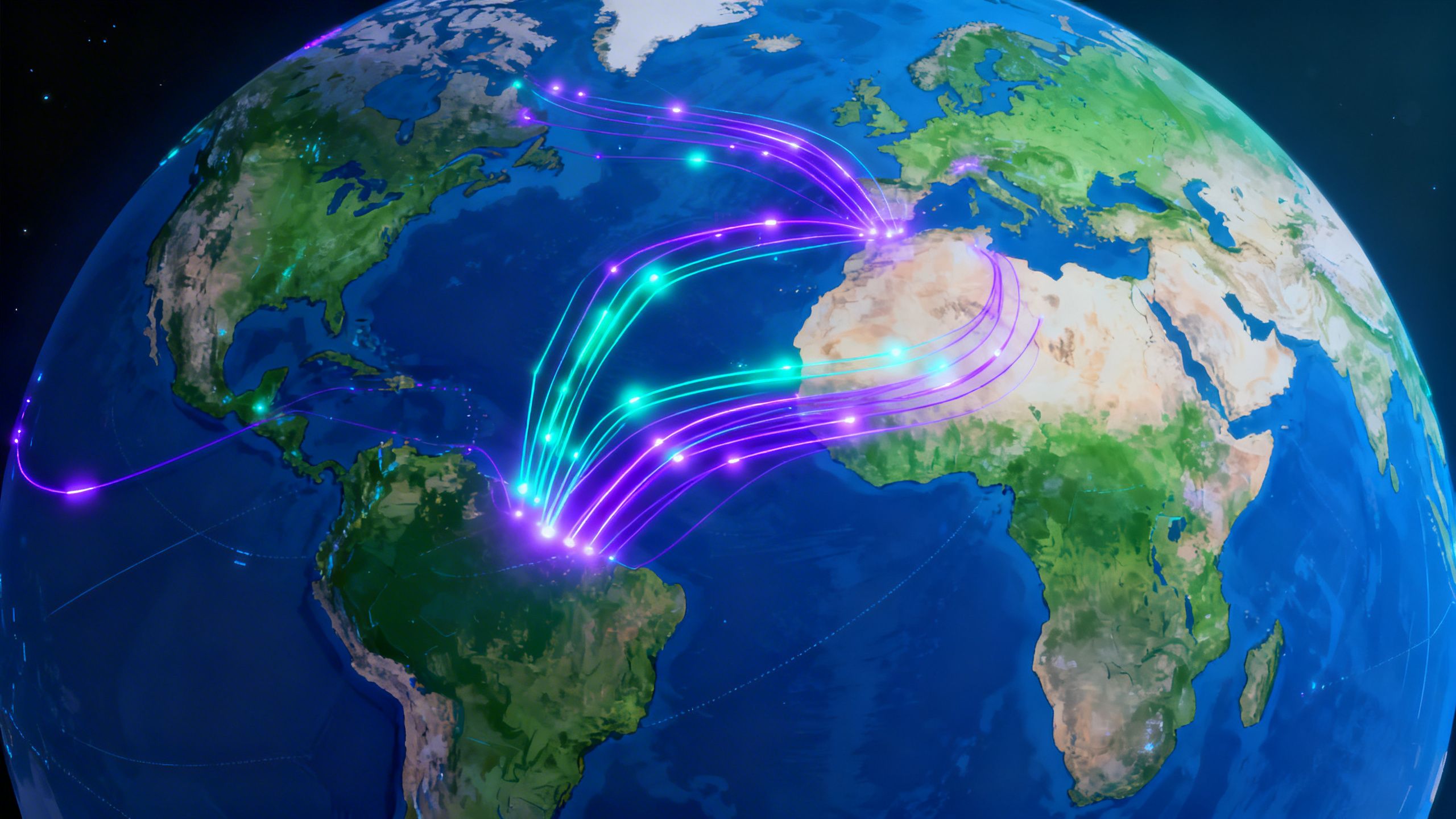
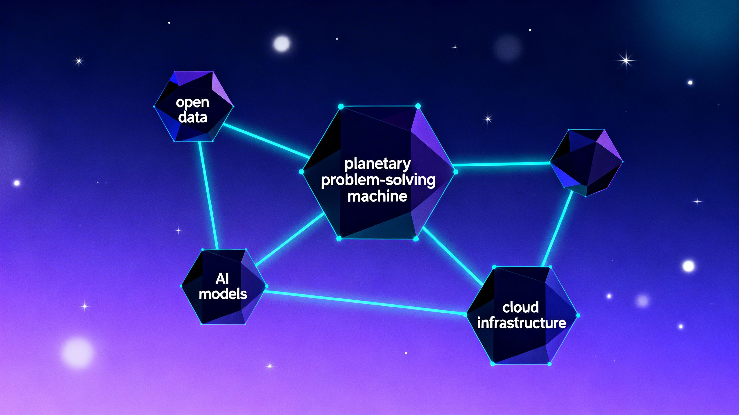
Advanced Strategy: Building the Planetary Problem-Solving Machine
The ultimate goal is to assemble what Vogels calls a "planetary problem-solving machine." This isn't a single piece of hardware or software, but an integrated system with three core components:
- Open Data: A foundation of transparent, verifiable, and publicly accessible information.
- Advanced AI Models: The engine that processes this data, extracting insights and making predictions at a scale impossible for humans.
- Scalable Cloud Infrastructure: The backbone that stores, processes, and delivers the data and insights anywhere in the world.
When these three elements work in concert, they can tackle challenges that were previously intractable. This is the pinnacle of using AI for good—creating a global, collaborative system for identifying and solving our most pressing problems.
Your Role in Building a Better World
The key takeaways are clear and actionable:
- Recognize the Data Divide: Be aware that standard data sources are often biased and incomplete. Actively question where your data comes from.
- Embrace Openness: Support and contribute to open data platforms. The more we share, the more powerful our collective insights become.
- Leverage AI for Insight: Whether you're running a non-profit or an eCommerce store, use AI tools like TrackIQ to translate complex data into clear, actionable intelligence.
Conclusion
The journey from Jim Gray's disappearance to the mapping of Makoko shows a profound evolution in our relationship with data. Maps are no longer just tools for navigation; they are instruments of justice, healthcare, and environmental stewardship. By making the invisible visible, we empower communities, save lives, and protect our planet.
The United Nations’ 17 Sustainable Development Goals all depend on geospatial data. The question Vogels leaves us with is one we should all ask ourselves: What data do we have that could be useful to others? And more importantly, what can we open up?
Whether you're tackling global poverty or optimizing your business, the path forward is clear: use data, use it wisely, and use it for good.
Now go build.
—